WATER RIGHTS MANAGEMENT
At THS Engineering, we offer management of water use rights, covering every stage, from on-site visits for data collection to the formal application process before the General Water Directorate (Spanish acronym DGA), including final approval and registration at the Real Estate Registry and the Public Water Catastre.
For surface water sources, we have high-precision GPS equipment and the technical capacity to identify the optimal water intake location, conduct topobathymetric surveys, and accurately georeference the project.
Our team has the knowledge and specialized equipment—such as flow measurement instruments—to conduct hydrological studies aimed at determining feasible flow rates that can be authorized, based on each client’s specific needs.
Our goal is to build long-term relationships with our clients by offering realistic, sustainable solutions that minimize future risks.
For groundwater sources, we conduct pumping tests, monitor water table levels, and assess water quality using specialized instruments.
We also provide services to identify and evaluate existing water rights that can be transferred and utilized at the location of your project.


We manage
Application for water rights (surface and ground)
Transfer or modification of water rights
Water right modification within the catchment area

INTAKE STRUCTURES PROJECTS
We conduct all the studies required by the DGA for submitting intake construction projects.
Our multidisciplinary team enables us to handle everything, from the design of new water intake structures to the regularization of existing ones.
For existing projects, we propose improvements and updates to optimize their operation and ensure compliance with current regulations.
Topobathymetric surveys
Hydrological studies (flood analysis)
Hydraulic modeling
Fluvial mechanics
Structural analysis
Compliance with effective water withdrawal controls
Compliance with ecological flow requirements
And more
We have experience developing projects in accordance with Articles 41, 151, and 294 of the Chilean Water Code.
We also manage the official acceptance of completed construction works (Recepcion de obras)
CHANNEL MODIFICATION PROJECTS, NATURAL OR ARTIFICIAL
We carry out all the studies required by the DGA to process channel modification projects in accordance with Articles 41 and 171 of the Chilean Water Code.
Our multidisciplinary team allows us to develop the design for new infrastructure or regularize existing ones through reverse engineering processes.
We also prepare the documentation necessary for the processing of Environmental Permits (PAS 156 and 157).

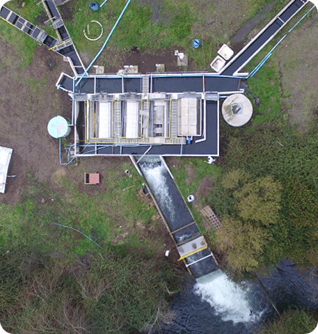
Among the projects we develop are:
Channel modifications for the discharge of industrial or domestic wastewater
Channel modifications for pipelines crossing surface watercourses
Channel modifications for the installation of river defense works, such as riprap and gabions
Channel modifications for sanitary chamber connections
And others
We also manage the official acceptance of completed construction works (Recepcion de obras).

TOPOBATHYMETRY
We have professionals specialized in Geomatics Engineering and cutting-edge technical equipment, allowing us to develop projects tailored to our clients’ requirements.
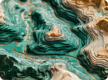
Our field equipment includes high-precision GNSS RTK positioning units and RTK-enabled drones equipped with 12 MP zoom cameras and LiDAR sensors.
For bathymetric surveys, we use echo sounding technology integrated with GNSS equipment.
Our topobathymetric surveys are processed based on client needs using software such as AutoCAD Civil 3D for infrastructure design and HEC-RAS for channel behavior modeling.

DRONE SERVICES
We are certified by the Chilean Directorate General of Civil Aeronautics (DGAC) as an Aerial Work Commercial Company using Remotely Piloted Aircraft Systems (RPAS), which enables us to safely carry out the aerial operations required by our clients.
We operate DJI drone equipment, including models such as the Matrice 350, Mavic 3E, and Phantom 4, among others. We also utilize LiDAR technology.
For our projects, we generate Digital Elevation Models (DEM), Digital Surface Models (DSM), Digital Terrain Models (DTM), and orthomosaics.
GEOMATICS
We have professionals from various engineering disciplines, including Civil Engineering, Environmental Engineering, Geomatics Engineering, Forestry Engineering, Geology, among others. Using geospatial data collected in the field, they are able to perform the modeling required by the client through Geographic Information Systems (GIS) and specialized modeling software.

TOPOGRAPHIC AND ENGINEERING DRAFTING
Our drafting unit is composed of professionals specialized in technical drawing, Geomatics Engineering, and Civil Engineering.
We perform field data collection and generate detailed drafts tailored to client requirements, using industry-standard tools such as AutoCAD, Civil 3D and rendering software.
SURFACE OR GROUNDWATER MONITORING
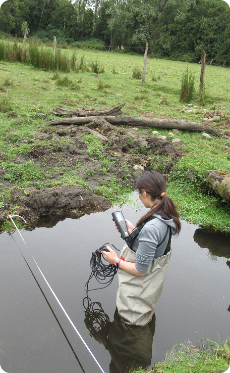
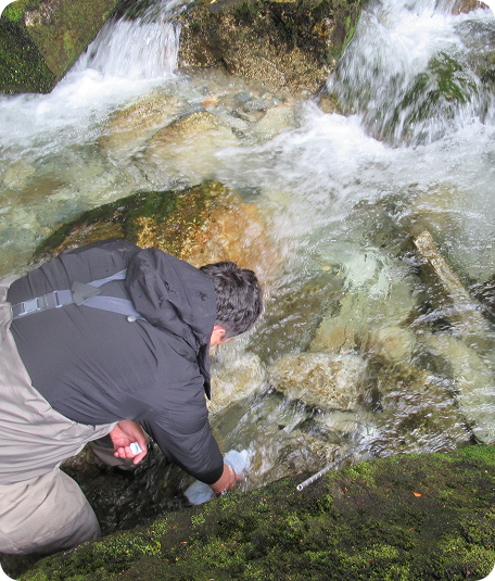
We are equipped to monitor both surface water bodies and pipelines. For surface watercourses, we perform flow measurements (stream gauging). In pipelines, we use portable flow meters to validate hydraulic designs.
We have experience installing and operating pressure sensors for surface water monitoring studies.
We also install staff gauges and develop discharge curves to monitor environmental flow on behalf of our clients.
For groundwater, we use water level probes to monitor the water table in our clients’ wells.
Additionally, by using multiparameter probes, we can monitor water quality in our clients’ projects.
REGULARIZATION OF PROJECTS BEFORE THE MINISTRY OF HEALTH
We have experience in the design and submission of projects such as:
Industrial wastewater treatment plants
Fish mortality ensiling systems
Sewerage projects
Drinking water supply systems
Hazardous waste storage facilities
Chemical storage facilities
And other projects requiring a Health Resolution
ENVIRONMENTAL STUDIES
Hydrogeology : We have experience conducting hydrogeological studies to determine the connection between surface and groundwater for our clients. We build conceptual models to assess the potential impact of water extraction on neighboring users.
Hydrology: We have experience performing floodplain studies for real estate development projects. Additionally, we can develop discharge curves for the installation of flow monitoring equipment.
Regulatory Compliance Audits: Through on-site inspections of our clients' facilities, we prepare regulatory compliance reports for civil works involving freshwater use—for example, identifying the type of authorization required and how to submit it.

CONTACT US